Why do big infrastructure projects always seem to be delayed?
Pick your reasons. There could be poor estimates during project planning, or poorly defined goals, or breaking ground on a project before the design is finalised.
Part of the problem - once the project is under way - is the unreliability of humans.
As Andrew Shaw, capital projects and infrastructure leader, PwC Africa, tells it, people employed to monitor a project who are supposed to be signing off on work being done, could be found to be inexplicably in two places at the same time.
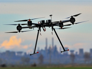
This kind of dodgy reporting, as well as disputes with sub-contractors, could all be things of the past if PwC's 'drone-powered solutions' are adopted.
The drone's-eye view, and more importantly the analytics derived from the images, will provide incontrovertible truth about the state of a project.
Michal Mazur, a PwC partner and global head of its drone powered solutions, was in the country recently meeting with, among others, corporates and state-owned enterprises as well as people from mining, agriculture and construction.
PwC's drone project started about five years ago in Poland, says Mazur, for no other reason than a 'purely regulatory' one. Poland was the first country in the world to implement a legal framework allowing for commercial drone flights.
"In Poland, if a pilot would like to fly his drone, there's an electronic system allowing him to get permission within 15 minutes. In the UK, it takes five days for an industrial company to receive permission."
In South Africa, commercial drone flights are allowed, but the operator has to have a remote pilot licence, among other certifications.
Disrupter
PwC thinks the total addressable value of drone-powered solutions in all industries is over $127 billion worldwide. Infrastructure is likely to be the most affected at $45.2 billion, followed by agriculture ($32.4 billion), transport ($13 billion) and security and surveillance ($10.5 billion).
Mazur said they had arrived at the figure by only taking drone use cases which actually exist, or had been proven to exist, and "weren't thinking about science fiction". They then calculated the value of current services and labour which were likely to be replaced by drone services.
Mazur recounted their first project - a flight over a construction site for a gas pipeline company in Poland - which had shown a man in a trench, sitting on the pipe and smoking a cigarette. He was also not wearing his helmet, and there was a welding machine five metres from him.
"We presented to the board and they ordered a stop to the construction and they wanted to terminate the contract with this construction company. Suddenly there's pressure for companies and workers to behave.
"This new type of data that we can acquire also changes the relationship between investors, construction companies and sub-contractors because now it's no longer based on trust or a lack of trust if they delivered five or 5 000 cubic metres of sand. Now, we gather the data from above and we generate 3D models."
Single view
This data provides a precise representation of the current state of the construction or infrastructure, and the 3D model can then be combined with, for example, construction plans, "removing the possibility of cheating".
Site managers will also be able to get a single view of the entire project.
The enabler is photogrammetry, or taking measurements from photographs, which unlocks proper planning.
Before the drone takes flight, flight routes are planned for data acquisition.
"What data do we want in the end? What are the KPIs in the construction project, and what's really important? We've seen construction projects where engineers are looking at 600 KPIs every week. We work with our clients to narrow it down and make it smarter."
Once the drone is on the ground again, photogrammetry and analytics are used to produce 3D models or orthophoto maps. These are known as geospatial products and are overlaid with the digital construction plans, after which a report on the 'real progress' of a project can be generated.
Apportioning blame
The integrated data, which is stored in the cloud, can then be viewed on a laptop, tablet or phone, Mazur says, adding the client would not need to download all the data - which could run to 60 gigabytes for, say, a flight over 2km of road construction. The report is also then made available to a range of actors: finance, health and safety, project managers, procurement, and the legal team, should that be necessary.
PwC's Shaw says a client will typically ask for verification that a project had been delivered to a certain point, at a particular time. If not, blame would need to be apportioned, and perhaps litigation.
With the drone solution, "we can see exactly where a project is in a point in time".
The images are also accurate to within a centimetre, enabling visibility into what materials are on the building site at any time.
"Typically one sub-contractor will say 'you didn't deliver the aggregate,' and this will actually tell you exactly what's on site and it'll measure the quantities. It makes that process of providing technical assurance much simpler for us. This provides you with absolute data. It's either in there, or it's not."
PwC report: Clarity from above
Share