A new computer application gives users a satellite view of the Earth in countless combinations of visible light imagery, low-light night-time imagery, and concentrations of ocean chlorophyll.
With Raytheon's VIIRS View, users can swoosh over storm patterns emerging above Antarctica or zoom in on fishing fleets lined up off the coast of Japan at night. They can also compare the relationship between chlorophyll in the ocean and continental shorelines.
VIIRS View provides a glimpse into the type of data meteorologists and climatologists use every day to track the weather and monitor the earth's environment. All of the data was generated by the Raytheon-built Visible Infrared Imaging Radiometer Suite currently flying aboard the National Aeronautics and Space Administration Suomi National Polar-orbiting Partnership spacecraft. Suomi NPP serves as the precursor to the next-generation weather and environmental forecasting Joint Polar Satellite System.
Users can change the levels of each dataset by adjusting the bars under tiny globes at the bottom of the screen. They can zoom in by clicking, or get more information by selecting the 'I' icon.
VIIRS collects data in 22 bands of the electromagnetic spectrum, providing critical information that can help improve planning, and reduce costs, associated with major weather events. VIIRS View illustrates three of these data sets:
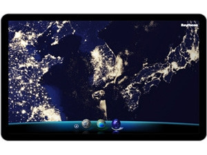
Visible imagery
Visible light imagery is essential for understanding the state of the global environment. Beyond the land masses and oceans, the most obvious daylight feature is cloud coverage. Cloud patterns give meteorologists not only a sense of current weather conditions at a specific location, but what the weather will be like several hours, or days, from now, as storms develop over the oceans and move across land.
Suomi NPP orbits the earth approximately 14 times each day, covering virtually the entire surface of the planet in each 24-hour period. The visible light image shown on VIIRS View is a composite of data obtained during the autumnal equinox in 2012.
Low-light imagery
VIIRS' "day-night band" establishes a new baseline for night-time earth imagery. Using extremely sensitive, specially calibrated sensing technology, it is able to detect objects roughly 100 times dimmer than the previous space instruments, while providing six times better spatial resolution. The day-night band clearly illuminates ground terrain, clouds, fog, ice and water with as little as a quarter moon illumination.
Since the launch of Suomi NPP in 2011, scientists have been using this data more and more to track weather around the clock, providing for more accurate and timelier forecasts. It's also proved valuable for disaster monitoring and response teams, who can, for instance, assess the extent of regional power outages via high fidelity night-time images. The image used in VIIRS View was developed by NASA as part of their Black Marble series.
Chlorophyll concentration
Chlorophyll concentration provides an indication of phytoplankton in the oceans, seas, lakes and rivers. Phytoplankton are single-celled algae and other plant-like organisms that, like plants on land, use chlorophyll to create photosynthesis.
By mapping the amount and location of phytoplankton, scientists gain valuable insight into the cyclical evolution of the ocean environment. The chlorophyll map in VIIRS View was produced from data collected in 2012.
VIIRS View is currently available for Mac and PC users. Mobile device versions are coming soon.
Share