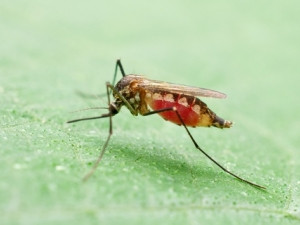
The University of Pretoria's use of satellite technology to predict malaria outbreaks and identify the environmental factors that allow malaria-spreading mosquitos to breed and thrive is beginning to pay off.
The University of Pretoria Institute for Sustainable Malaria Control (UP ISMC) has turned to satellite data to get a heads-up on malaria outbreaks, and smartphone apps to control and monitor the disease.
UP ISMC started with the "Remote Sensing for Malaria Control in Africa" programme that makes use of remote sensing earth observation satellites to collect data on variables that impact malaria. The initiative started last year together with the French National Centre for Space Studies, the South African National Space Agency, South African Weather Service and other stakeholders.
Since then, the researchers have been writing protocols and applying for funding towards a major cross-border study where satellites will be used to collect the relevant remotely sensed data.
"Using remote sensing as part of an early-warning system for outbreaks, we can forecast malaria occurrences from three to six months in the future," says UP ISMC doctorate student Abiodun Morakinyo Adeola.
"Our predictions using his model have been correct nine out of 10 times in all five Mpumalanga communities which formed part of the study. This level of accuracy is on par with the World Health Organisation's standards."
Professor Tiaan de Jager, director of the UP ISMC, explains that malaria-related or linked variable data are acquired by remote sensing earth observation satellites that are specifically programmed and equipped with optical instruments like infrared.
"The collected data is entered into various spacial, mathematical and statistical models to identify or determine specific patterns in the data that can be used in developing surveillance systems, risk maps and early-warning systems. The data collected remotely could also be used along with field-observed data," he points out.
Work has been done in the northern part of the Vhembe district, Limpopo province and directly across the border in Matabeleland South province, Zimbabwe, as part of the UP ISMC cross-border project.
From there, De Jager says the plan is to collect similar data in the Maputo province, Mozambique, specifically the Namaacha area near the Swaziland, Mozambique and South African borders.
Malaria is a parasitic disease transmitted by certain mosquitoes in the malaria risk areas in South Africa. De Jager says the disease in SA is located in the more north-eastern parts of the three endemic provinces of KwaZulu-Natal, Mpumalanga and Limpopo.
"KZN and Mpumalanga are both in the pre-elimination phase while Limpopo province, which has the highest malaria incidence in the country, is in the control phase. However, malaria incidence is second highest in Gauteng province due to taxi, suitcase or travel malaria, where the mosquitoes travel from the endemic areas to non-endemic areas in vehicles or suitcases of travellers. Another major problem for malaria control in South Africa is the high incidence of malaria in our neighbouring countries of Mozambique and Zimbabwe."
The research stemming from the programme will result in important outbreak detection and early-warning systems that will help in the fight against malaria, says De Jager.
On top of satellite tech, the varsity is also making use of mobile applications to control and monitor malaria. The mSpray app focuses on malaria control data management for the annual indoor residual spraying programme. It was developed at the University of California Berkeley with input from researchers at the UP ISMC. The other app is the Malaria Buddy, which provides information on malaria risk, prevention and symptoms for travellers in malaria endemic areas.
The indoor residual spraying programme is the current preferred method for malaria control in at-risk areas, says De Jager. And, until recently, there was no centralised digital database to ensure spraying was effective, regular and safe, he adds.
"Previously, the spray workers would go into homes, spray the walls and fill in cards. Come the next malaria season, they would go back and spray, but there was no clear database recording what substance was used, where was sprayed or when."
Share